Superior daylight-capability of the novel lidar systems
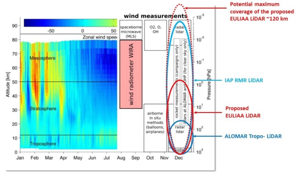
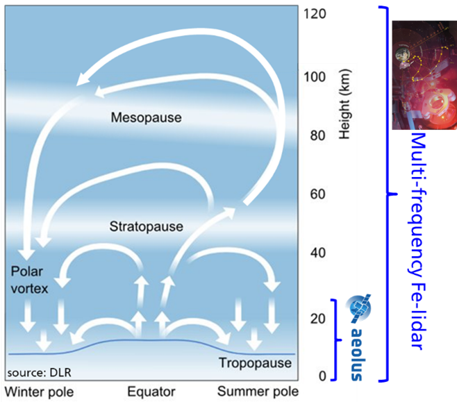
To demonstrate the superior daylight-capability of the individual low-cost and compact lidar system by measuring key parameters for monitoring climate change, e.g. wind, temperature, and aerosols with simultaneous Doppler-Rayleigh and -Mie during daylight at altitudes from 5 to 50 km. The lidar will have best performance in the troposphere, but even the altitude above 20 km will be continuously monitored with high resolution (line of sight wind error < 1m/s, temperature error < 1 K, 200 m binning, 5 min measuring) and even the maximum measurement range (up to ~25 km) of the Gold-Standard data provided by AEOLUS will be doubled. The spatial and temporal resolution at 20 km altitude will be comparable to the largest scientific radar systems (about 6000 m²) in the world, but the highest altitude reached will be twice as high, being 20 times higher than that of state-of-the-art commercial lidars. The data-gap within this currently inaccessible region of the atmosphere is closed using a novel Doppler-lidar array with multiple fields of view (FOV).
Demonstrate and validate the potential of a lidar array
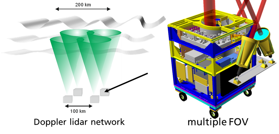
The combination of two individual compact lidar systems with overlapping measurement regions as the first step to a lidar array that is able to cover a large area (> 100 km observation span) and provides five wind-components for each system. An initial European lidar array of 10 units will allow for the observation of gravity waves throughout the upper troposphere and stratosphere, deepening the understanding of global atmospheric energy transfer important for understanding climate change and improving weather prediction. The measurements are validated with well-established scientific infrastructure (lidars, radars, sounding balloons) at leading European atmospheric research facilities and datasets from European databases like ECMWF and Copernicus.
Demonstrate performance in challenging environment all over Europe
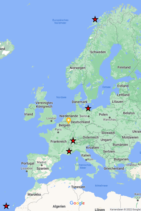
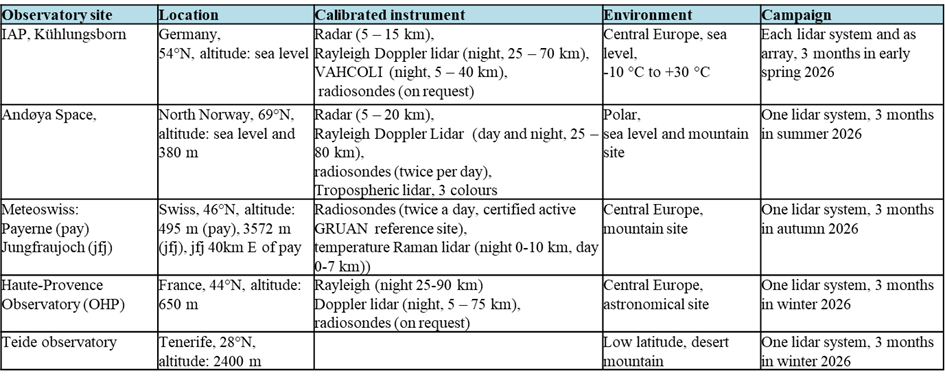
To prove the operation in areas facing extreme physical environments by performing measurements on at least four different sites with Polar (North Norway), Mountain (Swiss), Mediterranean (France) and near Equatorial (Tenerife) environments and from sea- to mountain-level. At each site, the gathered data is compared with the existing, elaborated, and calibrated measurement infrastructures, such as radars, lidars, and sounding balloons. The deployment to these sites demonstrates the easy deployment due to the compact design (~ 1m3), the low weight (~500 kg), and the autonomous 24/7-operation. The low power consumption (~500 W) allows the use of off-grid power sources such as small mobile wind turbines, solar panels, and fuel cells, and together with the maintenance-free operation, yields sustainable long-term observations. The experience with the operation of the lidar units allows for an assessment of the possibility of airborne operation of the lidar units with only slight adaptations.
Filling the gaps by integrating the data in European databases
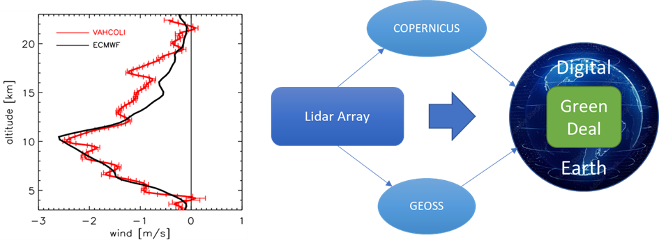
To add value to environmental observation not only by gathering data to fill the gap for continuous atmospheric key parameters > 10 km (see objective 1), but also by integrating them in near-real-time into European databases like Copernicus, making them available for the scientific community and the general public, while promoting the technology with the same measure and making it available to industry by the end of the project. This supports the goal of the Green Deal to develop a high precision digital model of the Earth, including the whole atmosphere, to boost the EU’s ability to predict and manage environmental changes.
Roadmap to a European lidar array for atmospheric climate monitoring
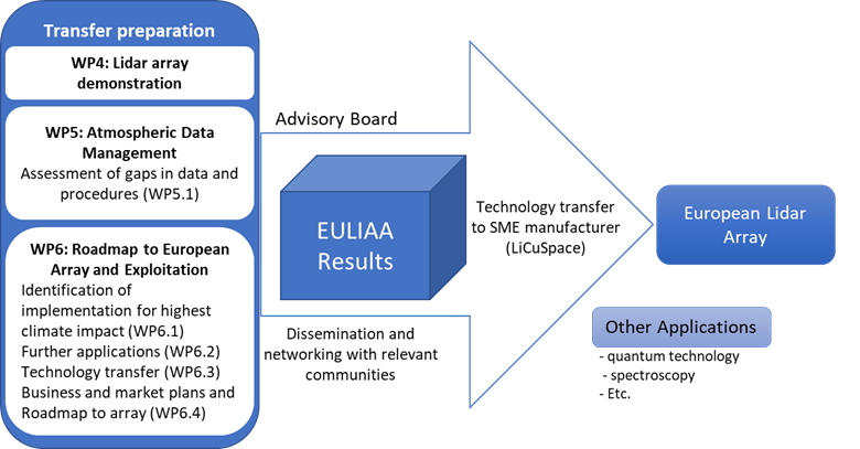
To ensure the sustainability of technological development by elaborating a roadmap to a European lidar array for atmospheric climate monitoring. EULIAA will assess the TRL status of all specific components, identify industrial partners for exploitation, and define the necessary next development steps. Together with industrial partners to whom the technology of the lidar operating in the IR is currently transferred, the necessary adaptations and additional transfers for the next generation operating in the UV and with multiple FOV will be assessed. Further applications like the deployment of calibration and validation of future spaceborne EO missions will be discussed with the identified stakeholders.
