The first EULIAA lidar unit was brought to operation at the Leibniz Institute of Atmospheric Physics (IAP) in Kühlungsborn. This sea-level site at the Baltic Sea served as the integration and commissioning platform for the infrared (IR) prototype and was the place where the full chain – from subsystems to atmospheric data products – was exercised for the first time.
After internal tests inside the closed housing (thermal stabilization, receiver spectral checks, internal laser characterization), the lidar was moved outside to the IAP test ground. Over several months in summer and early autumn 2025, the team iteratively refined hardware and control software, then switched to fully automatic operation. Between July and October 2025, the system accumulated several hundred hours of autonomous measurements without needing optical realignment or on-site maintenance.
The lidar, including the chiller was tested outside for several months in summer/autumn time and withstood ambient temperatures between 0 °C and 35 °C and local temperatures up to 50 °C in the direct sun. The temperature inside the lidar instrument was stabilized with variations < 1°C overall and for the optical section the variations can be further reduced by active compensation of the respective cooling.
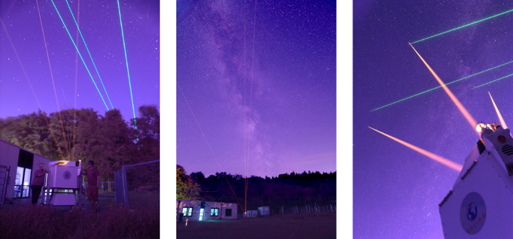
The lidar was mounted in an adapted elevated structure and wired to the ground. The lidar withstood a local storm with wind gusts > 180 km/h without damage and was operating up to 130 km/h before the safety measures were activated to prevent damages. Heavy rains and night frost did not cause water to ingress into the lidar instrument and dedicated heating of the telescope windows prevented dew of the outer optics.
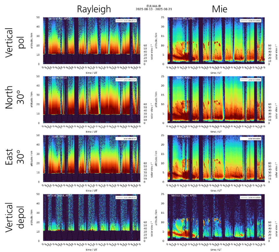
The standard observing scheme with three viewing directions (vertical, 30° north, 30° east) and a depolarization channel in the vertical was established here. Every four seconds the scanner switches to the next field-of-view, and each received signal is split into a Rayleigh and a Mie channel by the narrowband filter chain. Even in this early phase, the lidar delivered wind profiles from aerosol backscatter up to around 25 km and Rayleigh temperatures up to 50 km. Depolarization measurements already demonstrated their value by revealing the structure and phase of cloud and aerosol layers.
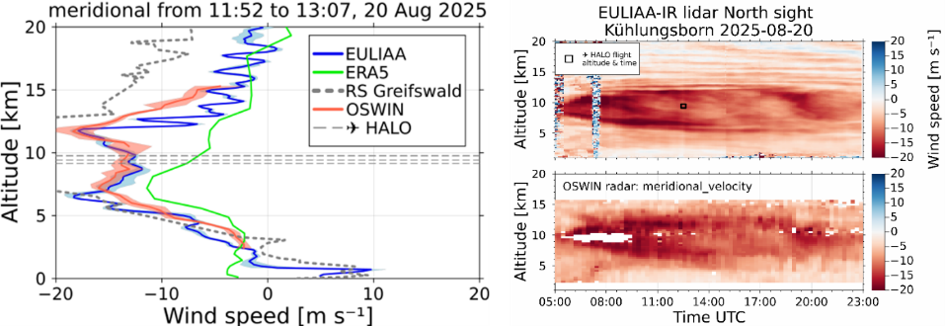
Kühlungsborn is also where the first systematic comparisons with reference systems took place. The EULIAA profiles and time series were compared with the co-located OSWIN radar, radiosondes launched from Greifswald, and ECMWF/ERA5 data. Agreement in wind and temperature was very good, while the lidar clearly resolved finer vertical and temporal structures than the radar. These results confirmed that the new instrument platform, telescopes, laser and receiver together met the performance targets defined in the design phase.
This campaign effectively closed the loop between design, manufacturing, testing, optimizing and real atmospheric operation and provided the benchmark for all subsequent deployments.